EVANSVILLE, Wis. (AP) — The first tornado ever recorded in Wisconsin in the usually frigid month of February came on a day that broke records for warmth, setting up the perfect scenario for the type of severe weather normally seen in the late spring and summer.
At least one tornado was confirmed south of Madison and the National Weather Service was investigating reports of several more spawned from storms that swept across the southeastern part of the state around 5:30 p.m. on Thursday, said meteorologist Taylor Patterson.
“There wasn't anything inherently unusual about any of these storms when you compare them to other types of severe events we see during the summer and spring," Patterson said Friday. “It’s just unusual in the sense that it doesn’t normally happen in February.”
Winter tornadoes are almost unheard of, especially in northern states.
The National Oceanic and Atmospheric Administration reported that between 1998 and 2022, 31 states across a broad swatch of the country, from Washington state in the northwest to New Mexico in the south, Wisconsin in the Upper Midwest over to Maine in the northeast, didn’t report a single tornado.
But winter tornadoes — like the one in Wisconsin — are likely to be stronger and stay on the ground longer with a wider swath of destruction in a warming world, a 2021 study showed. That comes after a 2018 study found that tornadoes were moving farther east, into states like Wisconsin.
Tornadoes are most common in Wisconsin over the summer months between May and August. Since 1948, between November and February fewer than a dozen tornadoes total had been reported before Thursday, according to the weather service.
Meteorologists in Wisconsin began to worry about conditions coming together to create severe weather earlier in the week and then on Thursday “we knew that there things were starting to align much more than we had thought two days ago,” Patterson said.
“All the ingredients coming together this time of year is what is unusual,” she said.
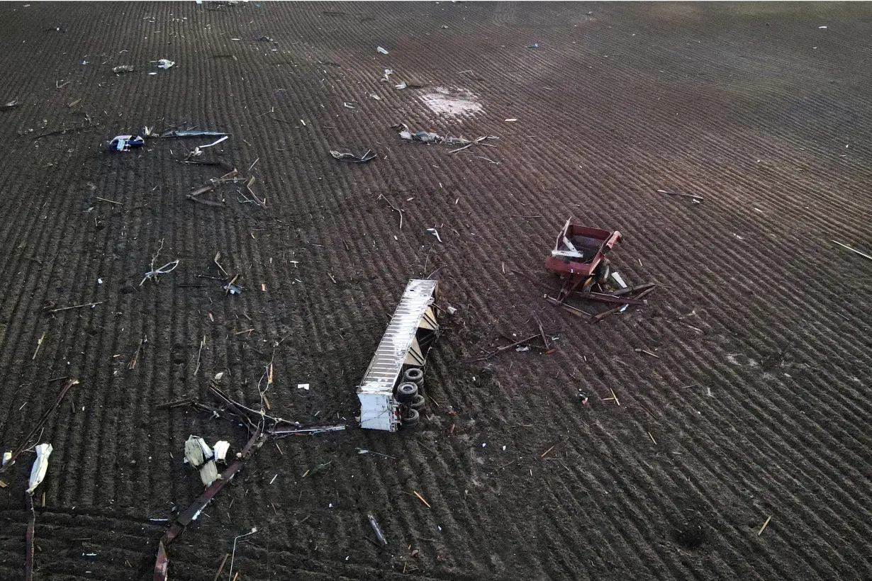
The weather service dispatched teams across the path of the storm on Friday to determine how many tornadoes there were and at what severity. Photos and video taken near Evansville, Wisconsin, that were posted on social media sites clearly showed a tornado with lightning flashing around it.
“February is normally a month where we’re very cold and we’re getting snow, which are things that aren’t very conducive to tornadoes,” Patterson said. “Normally, for thunderstorms severe enough to create tornadoes, we need a lot of moisture, we need a lot of warm temperatures and during the winter months we’re just normally not in an environment that is conducive for that.”
Conditions collided in Wisconsin late afternoon on Thursday creating the perfect conditions for tornadoes to form, Patterson said. That included rapidly warming temperatures that topped out at a record-tying 55 degrees Fahrenheit (13 Celsius) in Madison and more moisture with rapidly rising air, creating thunderstorms, Patterson said.
“The other thing that we had going for us is it was really windy yesterday,” she said, creating wind shear that is important for creating tornadoes. “That basically helps us sustain that rotation that is needed for tornadoes.”
There were no reports of significant injuries. Local emergency management officials reported dozens of buildings, power lines and other structures that were damaged across the path of the storm that began to form in eastern Iowa and died out around Milwaukee, which set a record high of 59 degrees (15 Celsius).
A study released last year found that America will probably get more killer tornado- and hail-spawning supercells as the world warms. The study in the Bulletin of the American Meteorological Society predicted a nationwide 6.6% increase in supercells and a 25.8% jump in the area and time the strongest supercells will be over land.

 Prized Japanese pitcher Roki Sasaki says he intends to sign with Los Angeles Dodgers
 Bribery, fraud charges dropped against former New York Lt. Governor
 Attorneys for fire victim say utility may have destroyed evidence of what caused deadly LA-area fire
 How to prepare for the next fire in LA
 Texas is already policing the Mexican border − and will play an outsize role in any Trump plan to crack down on immigration
 US to hit debt ceiling Tuesday, starting Congress’ countdown clock
 A battery plant fire in California started during a boom for energy storage
 What will happen to TikTok on Apple and Google's app store on Sunday?
 Titans hire Chiefs executive Mike Borgonzi as their general manager
 Jimmy Butler returns from suspension, set to play Friday for Miami against Denver
